Ground water Survey
The purpose of carrying out hydrogeological survey is to identify points which have potential for ground water, the depths of the ground water aquifer and where possible the extent.
At Envo-Hydro Solutions, we employ a number of techniques for precision thus identifying points with the highest potentials. A great variety of geophysical methods are available to assist in the assessment of geological subsurface conditions. In groundwater exploration, the most widely applied techniques are electrical resistivity surveying, electro-magnetical (EM) profiling and seismic refraction.
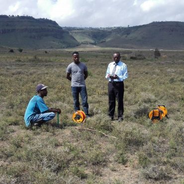
In electrical resistivity method, Horizontal profiling and vertical electrical sounding technique are normally used. An ABEM SAS 1000 Terrameter/ connecting cables and clips and stainless steel non-polarising current electrodes are used. This dedicated equipment measures both Voltage and Current presence and computed resistance. Using geo-metrical constants (K-factor), the apparent resistivity is calculated, and plotted as a function of the current electrode spacing AB.
Results are presented in graphical plots of the apparent resistivity versus electrode spacing AB/2, and the resulting geophysical interpretation model.
For sufficient supply of safe water to the client’s projects, utilization of groundwater resource will be of paramount importance.
The objective of the geophysical survey is normally to locate on the ground, at the selected sites, the best site for a borehole. This involved conducting Horizontal profiling (HEP) then Vertical Electrical Sounding at a point of low resistivity identified in HEP using ABEM SAS 1000 Terrameter instrument at selected points.
- Selection of AB/2 distance.
The term AB/2, which defines the spread of the electrode array and controls the depth of probe, is chosen to 200-300m. The choice is normally based on the information on depth of the basement formation in the area.
- Modeling and analysis of VES data
The modeling, analysis and evaluation of VES data is carried out by employing the Interpex 1X1Dv3.5 modeling software programme.